Andrews and Drewry map of 1777
|
|
|
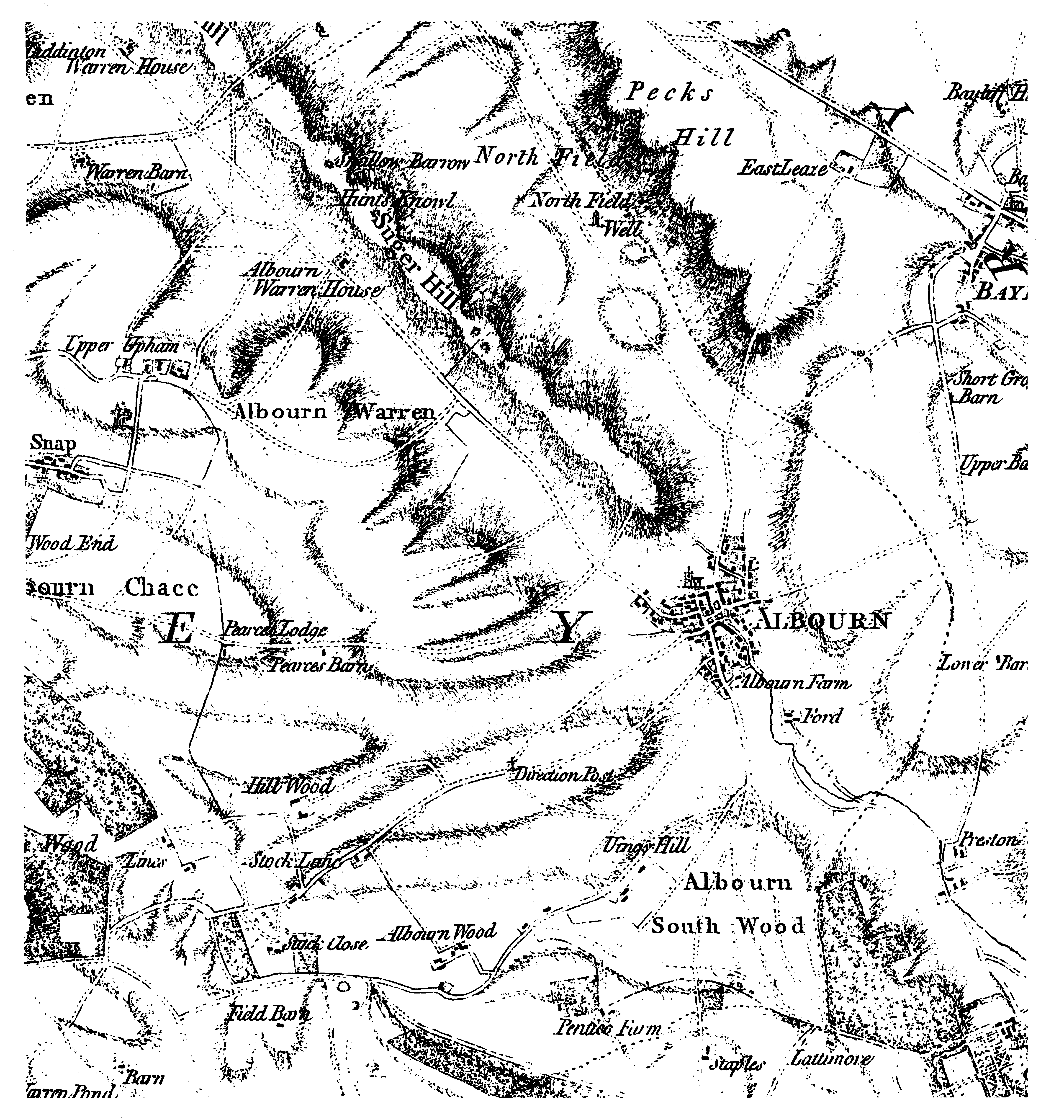
The above is part of the 1777 map of Wiltshire by the cartographers Andrews and Drewry. The original is on a scale of two inches to the mile (making the above about A4 size). It was one of the first English county maps done to this large scale, allowing individual houses and farms to be shown. It uses shading to show height. The dotted line to the east of the village is the parish boundary. The name Aldbourne is spelt Albourn and on old maps (some of which date back 400 years) the place tends to be called Aldbourn or even Abourn. Older village residents, the true Dabchicks, are said to still pronounce the word as Abourn. Richard Price (of Beech Knoll, Aldbourne), writing in The Dabchick, the Aldbourne bi monthly magazine, noted that the map showed the road to Hungerford running to the west of Ford Farm rather than to the east. "There was obviously a different way to get up to Snap from the village," he continued. "Is there any trace of this track now? "The road up Oxford Street to Baydon has either been changed or has been inaccurately drawn. And interestingly the spelling of Ewins Hill has change from Uings Hill." |
| Family history story | Main index |
| Aldbourne picture postcard village |